August 17, 2023
What does exploring Canada’s deep ocean look like?
Estimated reading time: 0 minutes
BY: Jennifer Whyte
Topics: Protect Marine Habitat
Incredible worlds teeming with life exist just off the coast of Canada, deep under the surface of the sea. Formerly out of reach and far past diving depths, our understanding of these worlds was once gleaned from community knowledge and what had been caught, washed ashore or risen to the surface. In the past several decades, our connection to and understanding of deeper ocean habitats has shifted forever. Today, we can document marine life far from the ocean surface by sending incredible technology to the ocean floor, allowing us to conduct surveys of marine life, share findings in real-time and connect people across Canada with the importance of ocean protection.
Expeditions
Oceana Canada has conducted expeditions in all three of Canada’s oceans: the Gulf of St. Lawrence in the Atlantic Ocean, fjords in the Central Coast of British Columbia, seamounts in the northeast Pacific Ocean and Arctic waters of Nunatsiavut, Northern Labrador. Ocean exploration is a challenging task and requires leading experts, which is why Oceana Canada partners with Indigenous Peoples, academics, the government and other non-profits on each of our expeditions. This collaboration is key to bringing the wonders of the sea within reach. However, teamwork alone can’t take you to the deep ocean, you also need some high-tech equipment.
Here are some of the technologies used for exploring the deep sea:
Remotely Operated Vehicle (ROV)
ROVs are the robots of the sea. These unoccupied machines are very maneuverable and have a variety of capabilities, allowing them to support ocean exploration in a wide range of habitats. Some have been designed to withstand extreme environments, including depths of thousands of meters below the surface. ROVs can have dexterous arms that take samples, including from the soil, corals or water. They often have camera equipment that makes it possible to visually survey marine life. High-quality videos and photos can be streamed, bringing researchers and anyone interested in the ocean along for the ride. ROVs can be directed by people on the ship or from farther away on shore, meaning researchers can participate in surveys and sampling without ever leaving land.
Watch highlight videos from the Gulf of St. Lawrence and Northeast Pacific Seamount expeditions, where ROVs were deployed to survey corals, sponges and species like redfish, Northern cod and rockfish.
Environmental DNA (eDNA)
As species move through an environment, they leave little pieces of themselves along the way. Cellular material is continually shed by marine organisms in the ocean, too. DNA technology allows researchers to test the water and identify what species are swimming by. Visual surveys used to be how researchers connected an animal, such as a fish, with its habitat; now we don’t even need to see the fish to know where it lives. For eDNA to work, it also depends on a vast database of DNA that researchers have been compiling for a long time. These libraries of species are used to cross-reference new samples, making identifying a specific type of marine life and who they are related to easier than ever. The tools for this on an expedition vessel are relatively simple: the ability to take water samples, which can even be done by some ROVs, as well as document where the sample was taken. This makes eDNA a relatively cost-effective and accessible tool to add to the ocean exploration toolbox.
Drop Camera and Baited Cameras
While ROVs are top-notch for visually surveying and sampling ocean ecosystems, they aren’t always the best technology for the job. They need a lot of equipment to deploy and run, making expeditions utilizing them very expensive, logistically challenging and requiring a lot of staff. This means that it is not always possible to use an ROV. Luckily there are other options to survey the ocean floor. Drop cameras are high-resolution waterproof cameras typically affixed to a frame or towable sled. They can be deployed off vessels at sea and, with lots of coordination with the crew, used to conduct visual transects which are designated routes to survey an area. A drop camera was used in Oceana Canada’s expedition to the Central Coast of British Columbia, deployed to depths of 200 meters to study fjord habitats that are home to complex rocky reefs with a high diversity of rockfish, corals and basket stars.
When Oceana Canada was in Nunatsiavut, Northern Labrador, the Imappivut expedition team used both drop cameras and baited cameras to document marine life during a 10-day expedition. The baited cameras used attached bags of squid to attract various species and photos were taken to document any activity. In Nunatsiavut’s Arctic waters many species, including a Greenland shark, were documented using baited cameras.
Visual survey
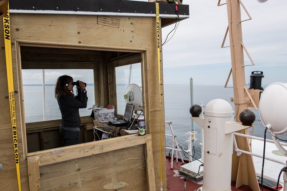
During an expedition, multiple types of data can be collected at the same time. While cameras are surveying the seafloor, researchers can also monitor the sea surface. Visual surveys are a key tool to document sightings of marine animals such as seabirds and whales. During the Gulf of St. Lawrence expedition gannets, humpback whales and even a North Atlantic right whale were spotted.

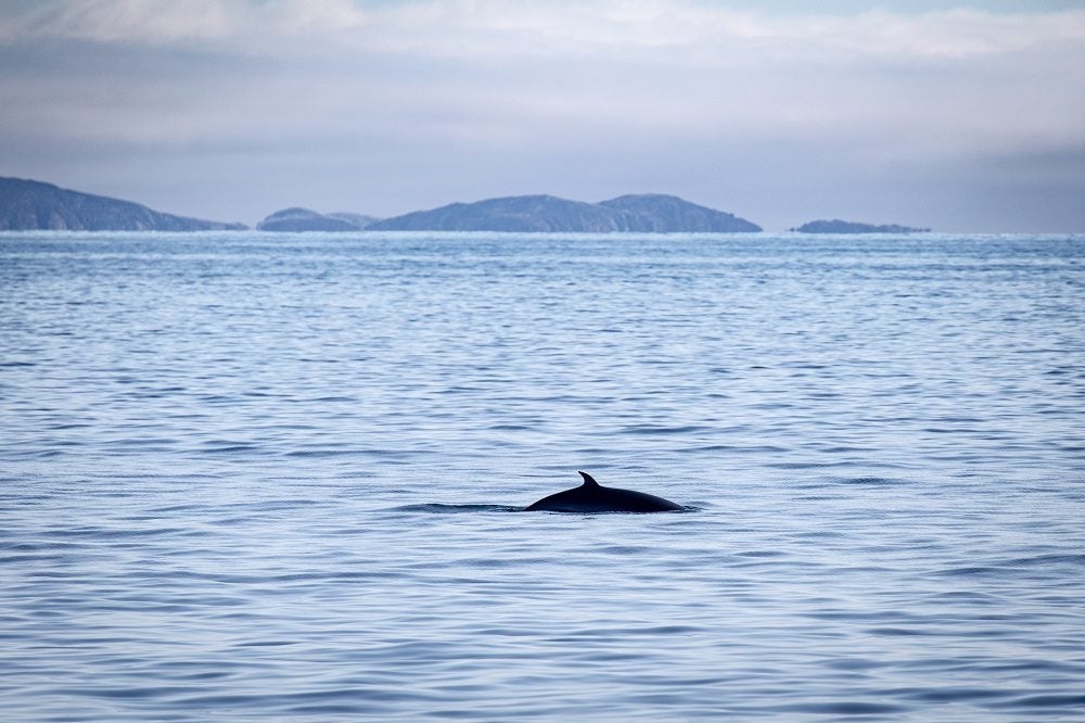
On the Central Coast, researchers documented pilot whales and on the Northeast Pacific Seamounts a tufted puffin and humpbacks were observed. While in Nunatsiavut a minke whale was seen. The tools for these visual surveys are much more accessible outside of a large expedition: a pair of binoculars, pen and paper or something to take notes and perhaps a reference book to confirm species identification.

All of these technologies are used to explore the ocean, increasing our understanding of marine life and complex ecosystems. Oceana Canada applies these ocean expedition findings to our habitat protection campaign, informing how to best protect incredible underwater habitats and the diversity of life we are still getting to know.
You can help protect the ocean by advocating for what could become Canada’s newest Marine Protected Area off the coast of British Columbia: Help protect the Northeast Pacific Seamounts, add your voice to our petition today.
MOST RECENT
March 6, 2025
February 3, 2025
January 22, 2025
Celebrating New Beginnings in 2025: Four Right Whale Calves Spotted Off Florida Coast

